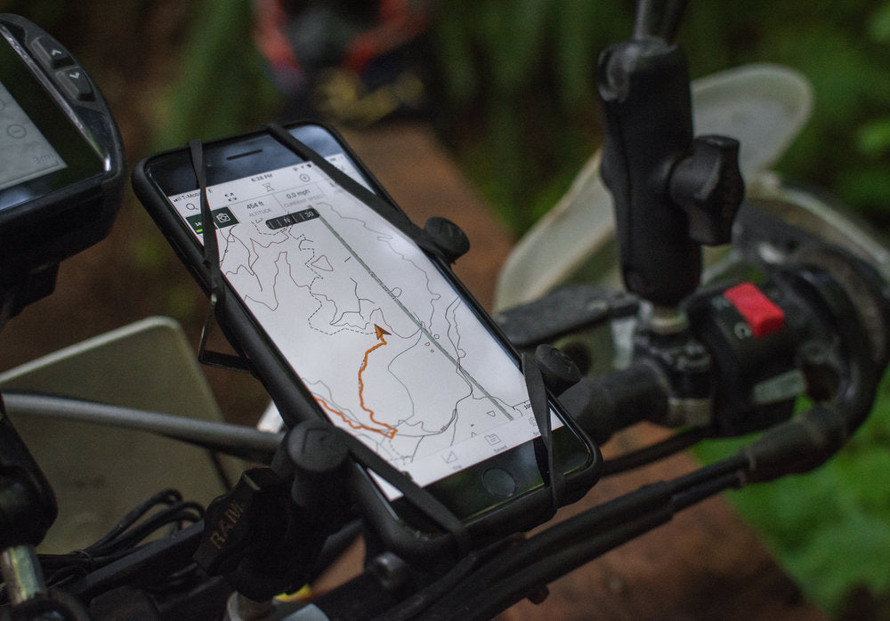
Navigation for your motorcycle is already in your pocket.
One of the most common questions I see asked on the PNWDS Facebook group is "Are any of you using a cell phone as a GPS?". With today's smartphone technology, GPS apps are a great way to navigate during an adventure.
Phones are great as a navigation tool for many reasons. You most likely already own a smartphone capable of GPS navigation, and they also come in handy as a backup to your dedicated GPS unit. In a lot of ways, the apps are actually easier to use than a dedicated unit is.
A very common misunderstanding when people first hear of these apps, is that they won't be able to use them if they don't have cell service. This is actually false. Modern smartphones use the same type of GPS signal receiver as a stand-alone GPS unit, which means your phone is capable of acquiring your accurate location as long as it has connection with GPS satellites. So, almost anywhere! However, here's the catch: even though the app will be able to pin-point your exact location without cell service, it won't be able to download detailed map data if you don't have cell reception to download that data.
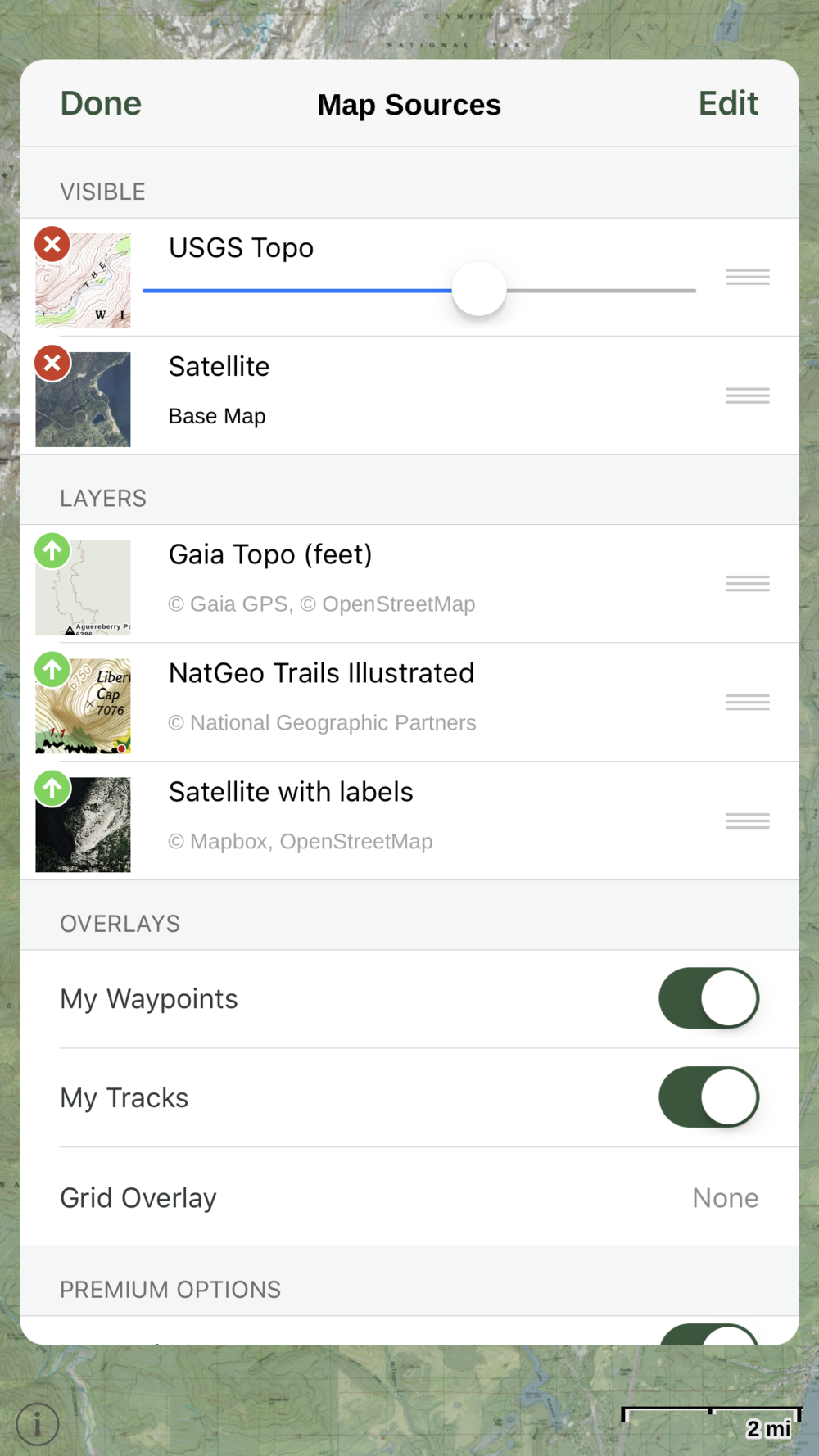
The solution to that issue is the right app! Our favorite we have found is a free app called Gaia, which also has premium features that allow you to use some great map overlays, and even download detailed overlays of each of those maps for offline use. That means you can use those maps in detail without cell reception!

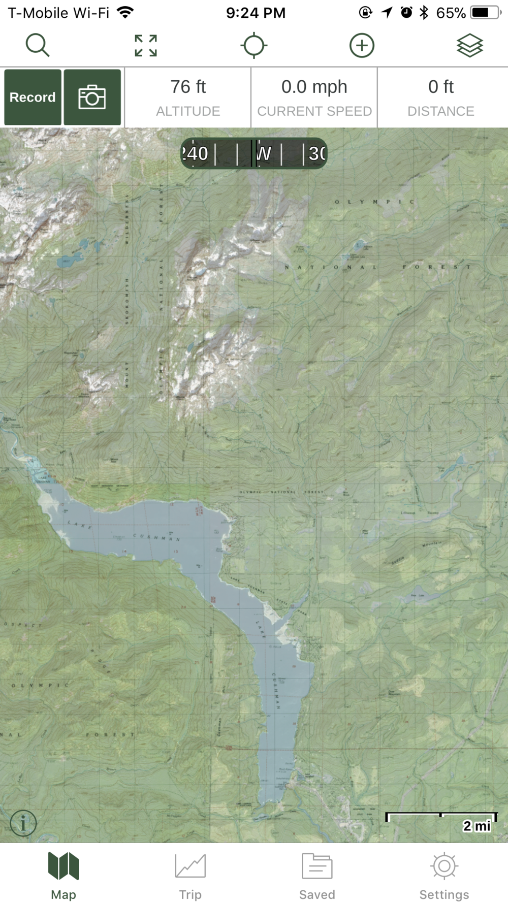
The free version of Gaia has Gaia Topo maps available for use:

Most of us like to use these apps to "bread-crumb" our way as we explore, so we can record our path to save, or to help us find our way back where we started. We also like to get tracks from others, so we can follow a specific route. As soon as you have finished recording your route, just click the timer in the top left corner and save the track.
Here's an example of the free version of Gaia, while we tracked our way down some trails in Capitol Forest:

Dropping in GPX files made by others into the app is easy. Follow the steps below to see how it's done using Gaia:

Find the GPX you want to download, like this one from the PNW Dual Sport 2018 Summer Opener event.
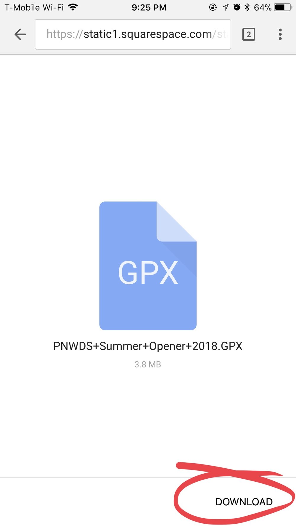
Choose “Download”

Select “Open In”
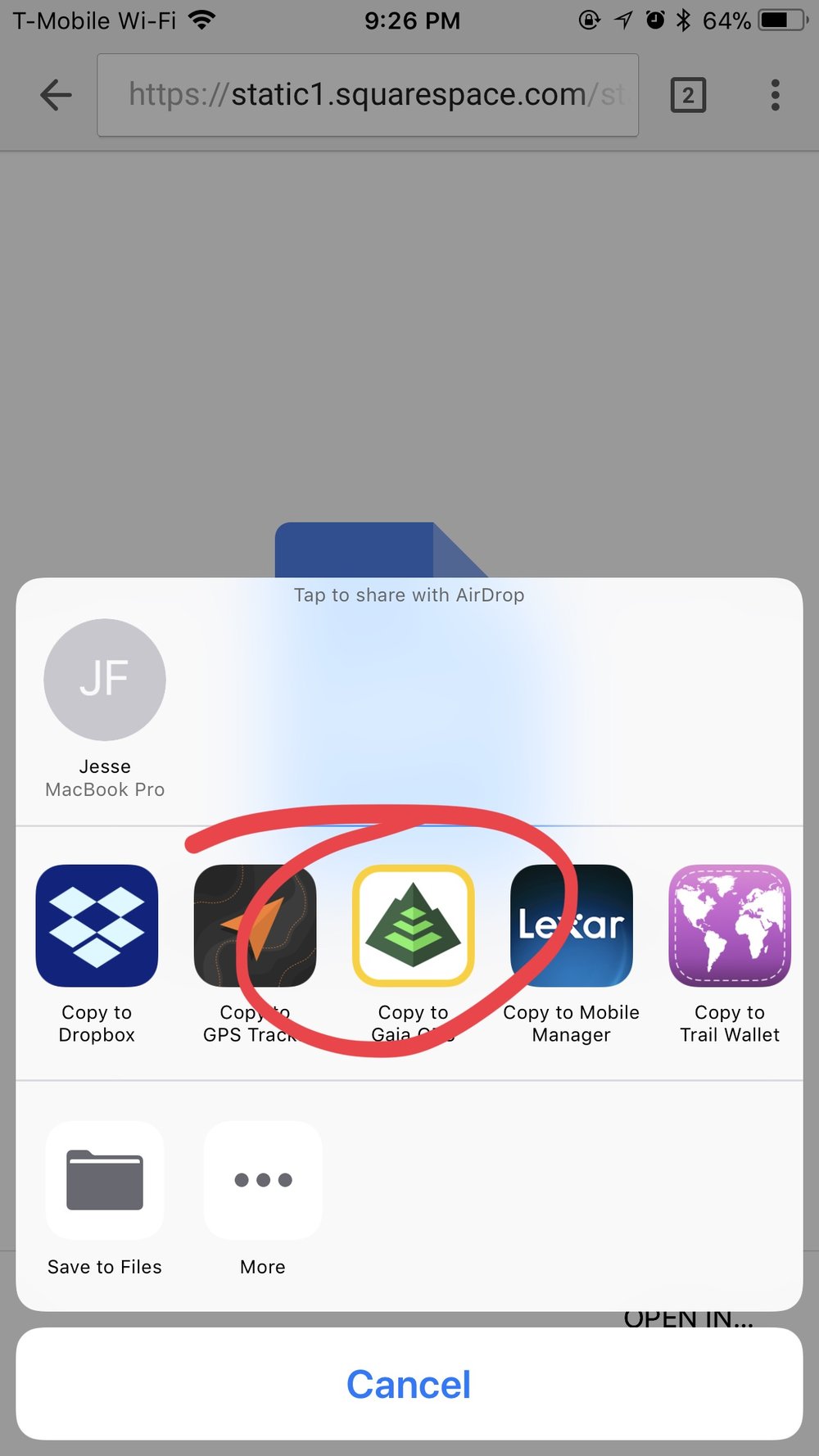
Choose the Gaia app
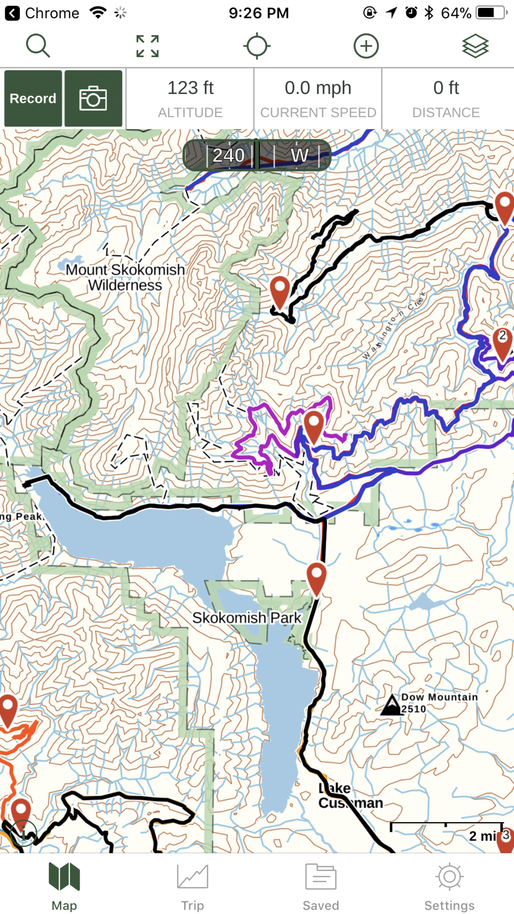
The tracks, waypoints, and routes will automatically populate

Choose which map overlays to use
Premium features of Gaia include map overlays (Satellite, USGS Topo, NatGeo Illustrated, etc), the ability to download these map overlays, and even layer them on top of one another.


Selecting the area of the map to download for offline use.
Get started navigating by visiting GaiaGPS.com, and grab the app for free.
Get 20% discount on Gaia Premium, follow this link: http://www.gaiagps.com/discounts/#_r_pnwds
Have fun tracking your rides!
